


Yutan Precinct, Saunders County, Nebraska
About
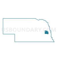
Outline

Summary
| Unique Area Identifier | 613878 |
| Name | Yutan Precinct |
| County | Saunders County |
| State | Nebraska |
| Area (square miles) | 68.99 |
| Land Area (square miles) | 66.75 |
| Water Area (square miles) | 2.24 |
| % of Land Area | 96.75 |
| % of Water Area | 3.25 |
| Latitude of the Internal Point | 41.21056190 |
| Longtitude of the Internal Point | -96.40141350 |
Maps


Graphs
Select a template below for downloading or customizing gragh for Yutan Precinct, Saunders County, Nebraska


Neighbors
Neighoring Voting District (by Name) Neighboring Voting District on the Map
- Ashland Rural Precinct, Saunders County, NE
- Ceresco Precinct, Saunders County, NE
- District 4 Precinct, Saunders County, NE
- Marietta Precinct, Saunders County, NE
- Melia Forest City 1 Precinct, Sarpy County, NE
- Precinct 8-49, Douglas County, NE
- Precinct 8-82, Douglas County, NE
- Wahoo Rural Precinct, Saunders County, NE
- Yutan East Precinct, Saunders County, NE
- Yutan West Precinct, Saunders County, NE
Top 10 Neighboring County Subdivision (by Population) Neighboring County Subdivision on the Map
- Melia-Forest City precinct, Sarpy County, NE (4,999)
- Waterloo precinct, Douglas County, NE (2,487)
- Union township, Saunders County, NE (1,682)
- Marietta township, Saunders County, NE (843)
- Clear Creek township, Saunders County, NE (788)
- Leshara township, Saunders County, NE (526)
- Wahoo township, Saunders County, NE (410)
- Marble township, Saunders County, NE (409)
- Green township, Saunders County, NE (261)
Top 10 Neighboring Place (by Population) Neighboring Place on the Map
Top 10 Neighboring Unified School District (by Population) Neighboring Unified School District on the Map
- Gretna Public Schools, NE (15,513)
- Wahoo Public Schools, NE (7,198)
- Douglas County West Community Schools, NE (5,523)
- Ashland-Greenwood Public Schools, NE (4,880)
- Yutan Public Schools, NE (2,159)
- Mead Public Schools, NE (1,510)
Top 10 Neighboring State Legislative District Upper Chamber (by Population) Neighboring State Legislative District Upper Chamber on the Map
Top 10 Neighboring 111th Congressional District (by Population) Neighboring 111th Congressional District on the Map
Top 10 Neighboring Census Tract (by Population) Neighboring Census Tract on the Map
- Census Tract 106.31, Sarpy County, NE (4,421)
- Census Tract 9684, Saunders County, NE (4,221)
- Census Tract 9681, Saunders County, NE (3,210)
- Census Tract 75.04, Douglas County, NE (3,161)
- Census Tract 75.08, Douglas County, NE (2,479)